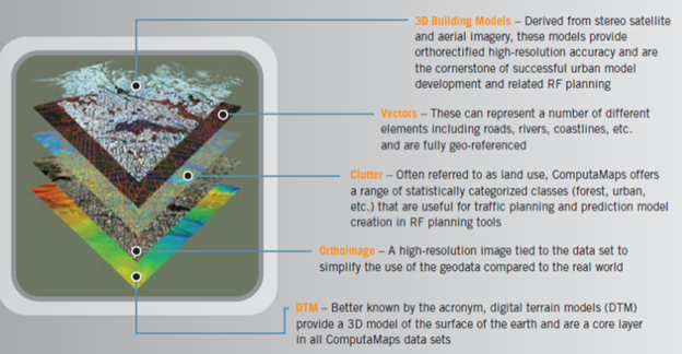
Kyocera Propel Network is currently working with an European partner to provide 3-D Digital Map. In the past, customers have used 2D medium resolution data (20m+) to plan their solution. Recently, we’ve witnessed a dramatic increase in demand for our 2.5D Urban Planner and 3D City Planner products as customers deploy complex solution. Using the latest in 3D software we create real-world, fully interactive, geographically accurate 3D models of entire cities. The city models are used in the following ways:
- Engineering
design
- Environmental modeling
- Real estate
- Security and law enforcement
- Tourism
- Urban planning
- Navigation
- Media and advertising
- Games and simulations